Home - Technology - Localization Service
Localization service
The Sensolus asset trackers provide 5 different geolocation technologies as different technologies are better suited for different situations. Depending on your use case, we will select the best technologies and activate them on your trackers.
WiFi is suited to indoor and outdoor localization in environments where WiFi access points are publicly or privately available.
Network triangulation is good for low precision localization and doesn’t require any additional infrastructure.
BLE is used for indoor localization using extra infrastructure like geobeacons or anchors for real-time or high-precision localizations.
Bluetooth high precision is used for specific indoor localization needs which allows for a smooth handover to outdoor localization.
From a battery-consumption perspective, a tracker should always sleep except when there is direct business value for the customer. Therefore Sensolus provides a set of different configurations to define when to wake the tracker and capture location.

When starting and/or stopping with -optionally- some intermediate locations (e.g., every 15 mins) while moving.

At fixed time intervals or at specific times during the day.

When a change in context occurs (e.g., orientation change when a container is emptied).

When an asset has moved more than a certain distance or it has exceeded a certain speed (e.g., moved more than 2000 meters and speed of more than 80 km/h)

While the first four location triggers have been initiated by the device, you can use BLE anchors and smartphones that scan for trackers to convert this into location data.
For optimal results, using one location technology is often not enough. Sensolus enables you to use a cascade of technologies. With the edge configurable rule engine, you can define this sequence remotely.
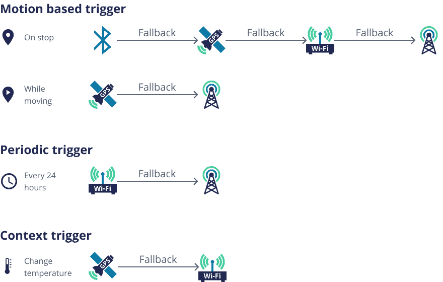
By combining different location tracking technologies, Sensolus provides asset location information. The choice of technology(ies) depends on the use case:
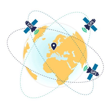
Sensolus constantly evaluates all new GPS chip releases to provide the most energy efficient tracker on the market.
Sensolus trackers extend battery-life with configurable GPS fix times depending on the needed location accuracy, indoor detection algorithms, and more.
Our cloud device management application provides all required information regarding GPS energy use, fix times, fix precision, and installation quality.
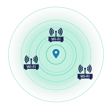
The tracker scans for WiFi access points (APs) in its surroundings and calculates its location based on the MAC addresses of the detected. This technology works well in urban areas, both indoors and outdoors.
Public WiFi location services are used to map the WiFi APs to a location. However, users can also define a private list of their own APs.
Our cloud device management application provides all information regarding the number of found addresses, resolution quality, WiFi scan energy consumption, and more.
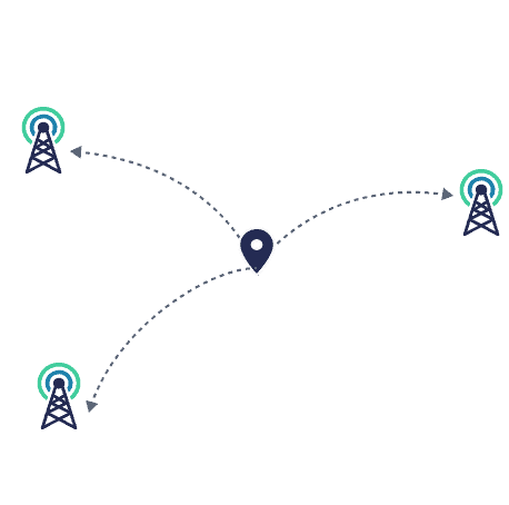
The tracker sends a Sigfox message which is received by one or more Sigfox basestations. The location is determined based on the signal strength.
There is a trade-off: the extremely low energy consumption means that the accuracy is also low (precision: kilometres) and only live messages can be sent.
The network location is also used as a back-up if other geolocations technologies are not available. This is defined using the edge configurable rule engine.
BLE geolocation technology is used in multiple ways for locating assets.
For optimising tracking of zones Sensolus provides different solutions: geobeacons for a quick and easy installation, smartphones and tablets for nomadic tracking, and BLE anchors for higher responsiveness of location information.
For higher precision of location, Sensolus trackers can be integrated with existing solutions (e.g., Quuppa).
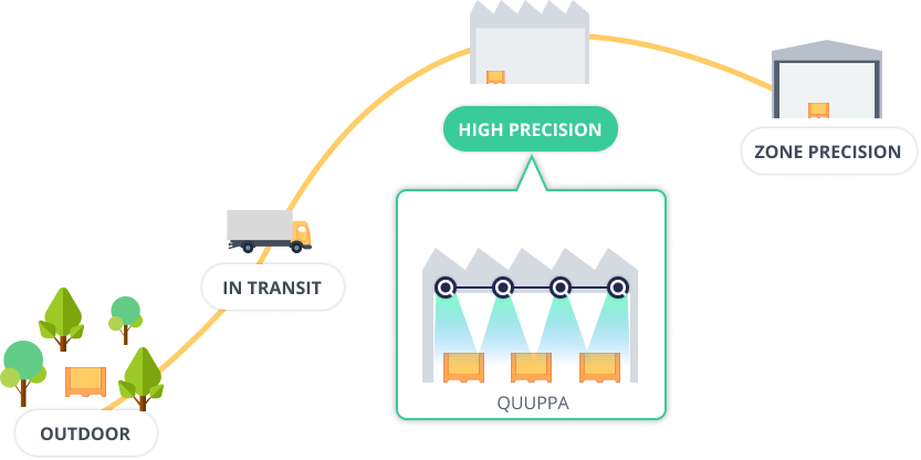
Do you need high precision localization at specific places, while also having the full visibility when these assets are outdoor localized or in other zone-level precision locations? Selected Sensolus battery powered trackers are also compatible with the Quuppa high precision tracking systems.
The Quuppa infrastructure uses Bluetooth angle of arrival detection to accurately determine the position. The trackers emit Bluetooth signals in such a way that detection by Quuppa Locator hardware is the most optimal.
The cloud platform merges the high-precision location data with the tracker data, providing an uninterrupted overview of the asset’s complete journey in a single user experience.
TRACK 1100 and TRACK 1110
We blend data from different location technologies on the cloud level for a consistent user experience and API.
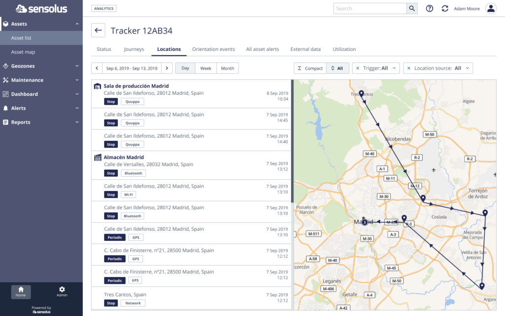
Take a look on how Tracking your Asset’s Location with Sensolus looks like on the Platform.